Know About ASSAM অসম (North East India ভাৰতৰ উত্তৰ-পূব ) | Rakibul Islam Salafi

Northeast India (officially North
Eastern Region, NER) is the easternmost region of India representing
both a geographic and political administrative
division of the country. It comprises eight states – Arunachal Pradesh, Assam, Manipur, Meghalaya, Mizoram, Nagaland, Sikkim and Tripura. The Siliguri Corridor in West Bengal, with a width of 21 to 40
kilometres (13 to 25 mi), connects the North Eastern Region
with East India. The region shares an international
border of 5,182 kilometres (3,220 mi) (about 99 percent of its total
geographical boundary) with the neighbouring countries – 1,395 kilometres
(867 mi) with Tibet Autonomous
Region, China in the north, 1,640 kilometres (1,020 mi)
with Myanmar in the east, 1,596 kilometres
(992 mi) with Bangladesh in the
south-west, 97 kilometres (60 mi) with Nepal in the west and 455
kilometres (283 mi) with Bhutan in the north-west. It comprises an
area of 262,230 square kilometres (101,250 sq mi), almost 8 percent
of that of India, and is one of the largest salients (panhandles) in
the world.
The
states of North Eastern Region are officially recognised under the North Eastern Council (NEC), constituted
in 1971 as the acting agency for the development of the north eastern states.
Long after induction of NEC, Sikkim formed part of the North Eastern Region as
the eighth state in 2002. India's Look-East
connectivity projects connect Northeast India to China
and ASEAN.
History
 |
| The traditional map of Kamarupa from first millennium sources |
The earliest settlers may have been Austro-Asiatic speakers from Southeast Asia, followed by Tibeto-Burmese from China and by 500 B.C. Indo-Aryans speakers from Gangetic Plains. Due to the bio- and crop diversity of the region, archaeological researchers believe that early settlers of Northeast India had domesticated several important plants. Writers believe that the 100 BC writings of Chinese explorer, Zhang Qian indicate an early trade route via Northeast India. The Periplus of the Erythraean Sea mention a people called Sêsatai in the region, who produced malabathron, so prized in the old world
In
the early historical period (most of first millennium), Kamarupa straddled
most of present-day Northeast India, besides Bhutan and Sylhet in
Bangladesh. Xuanzang, a travelling Chinese Buddhist monk, visited Kamarupa in
the 7th century. He described the people as "short in stature and
black-looking", whose speech differed a little from mid-India and who were
of simple but violent disposition. He wrote that the people in Kamarupa knew
of Sichuan,
which lay to the kingdom's east beyond a treacherous mountain. For many of the tribal peoples, their
primary identification is with subtribes and villages, which have distinct
dialects and cultures.
The
north-eastern states were estblished during the British Raj of
the 19th and early 20th centuries, when they became relatively isolated from
traditional trading partners such as Bhutan and Myanmar.
Many of the peoples in present-day Mizoram, Meghalaya and Nagaland
converted to Christianity under the influence of British (Welsh) missionaries.
Formation of North Eastern states
In
the early 19th century, both the Ahom and
the Manipur kingdoms
fell to a Burmese invasion. The ensuing First Anglo-Burmese Warresulted in the
entire region coming under British control. In the colonial period (1826–1947),
North East India was made a part of Bengal Province from
1839 to 1873, when Assam became its own province.
After Indian
Independence from British Rule in
1947, the North-eastern region of British India consisted
of Assam and
the princely states of Manipur and Tripura.
Subsequently, Nagaland in 1963, Meghalaya in
1972, Arunachal Pradesh in 1975 (capital changed
to Itanagar) (formed on 20 February 1987) and Mizoram in
1987 were formed out of the large territory of Assam. Manipur and Tripura
remained as Union Territories of India between 1956
until 1972, when they attained fully-fledged statehood. Sikkim was
integrated as the eighth North Eastern Council state in 2002.
The
city of Shillong served
as the capital of the Assam province created during British Rule. It remained
as the capital of undivided Assam until formation of the state of Meghalaya in
1972. The capital of Assam was
shifted to Dispur,
a part of Guwahati,
and Shillong was designated as the capital of Meghalaya.
 |
| Assam annexation to British India in 1838. |
 |
| Eastern Bengal and Assam in 1907 |
|
State
|
Historic Name
|
Capital(s)
|
Statehood
|
|
1987 (earlier a Union Territory of India, constituted in 1971)
|
|||
|
1947
|
|||
|
Kangleipak
|
1971 (earlier a Union Territory of India, constituted in 1956)
|
||
|
Khasi hills, Jaintia hills and Garo hills
|
1971
|
||
|
1987 (earlier a Union Territory of India, constituted in 1971)
|
|||
|
Naga hills
|
1963
|
||
|
Sukhim
|
1975
|
||
|
Tipperah
|
1971 (earlier a Union Territory of India, constituted in 1956)
|
Seven Sister States
 |
| Seven Sister States |
The Seven
Sister States is a popular term for the contiguous states of
Arunachal Pradesh, Assam, Meghalaya, Manipur, Mizoram, Nagaland and Tripura
prior to inclusion of the state of Sikkim into the North Eastern Region of
India. The sobriquet 'Land of the Seven Sisters' was coined to
coincide with the inauguration of the new states in January 1972 by Jyoti
Prasad Saikia, a journalist in Tripura, in
the course of a radio talk show. He later compiled a book on the
interdependence and commonness of the Seven Sister States, and named it
the Land of Seven Sisters. It has been primarily because of this
publication that the nickname has caught on.
World War II
In 1944, the Japanese planned a daring attack on India.
Traveling through Burma, its forces were stopped at Kohima and Imphal by
British and Indian troops. This marked the furthest western expansion of the
Japanese Empire; its defeat in this area presaged Allied victory.
Sino-Indian
War (1962)
Arunachal Pradesh, a state in the North-eastern tip of India, is
claimed by China as South Tibet. Sino-Indian relations degraded, resulting
in the Sino-Indian War of 1962. The cause of the
escalation into war is still disputed by both Chinese and Indian sources.
During the war in 1962, the PRC (China) captured much of the NEFA
(North-East Frontier Agency) created by
India in 1954. But on 21 November 1962, China declared a unilateral ceasefire,
and withdrew its troops 20 kilometres (12 mi) behind the McMahon Line.
It returned Indian prisoners of war in 1963.
Geography
 |
| Brahmaputra plain and Eastern Himalaya in Northeast India |
The Northeast region can be physio graphically categorised into the Eastern Himalaya, the Patkai and the Brahmaputra and the Barak valley plains. Northeast India (at the confluence of Indo-Malayan, Indo-Chinese, and Indian biogeographical realms) has a predominantly humid sub-tropical climate with hot, humid summers, severe monsoons, and mild winters. Along with the west coast of India, this region has some of the Indian sub-continent's last remaining rain forests, which support diverse flora and fauna and several crop species. Reserves of petroleum and natural gas in the region are estimated to constitute a fifth of India's total potential.
The
region is covered by the mighty Brahmaputra-Barak river systems and their
tributaries. Geographically, apart from the Brahmaputra, Barak and Imphal valleys
and some flat lands in between the hills of Meghalaya and Tripura,
the remaining two-thirds of the area is hilly terrain interspersed with valleys
and plains; the altitude varies from almost sea-level to over 7,000 metres
(23,000 ft) above MSL. The region's high rainfall, averaging around 10,000
millimetres (390 in) and above, creates problems of ecosystem, high
seismic activity, and floods. The states of Arunachal
Pradesh and Sikkim have a montane climate
with cold, snowy winters and mild summers.
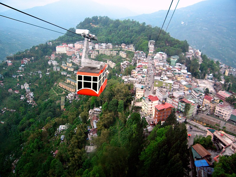 |
Ropeway, Gangtok |
 |
| Aizawl, Mizoram |
 |
Aerial view of Shillong |
 |
| Dzükou Valley (Borders of Manipur and Nagaland) |
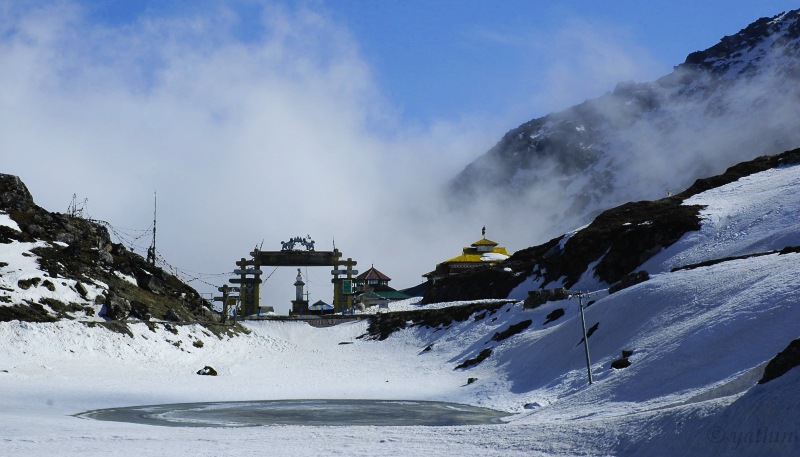 |
| Sela Pass, Tawang (Arunachal Pradesh) |
 |
| Bhalukpong, Arunachal Pradesh |
 |
| Loktak lake, Manipur |
 |
| Majuli Island, Assam |
 | |||||||||||||||||||||||||||||||||||||||||||||||||||||||||||||||||||||||||||||||||||||||||||||||||||||||||||||||||||||||||||||||||||||||||||||||||||||||||||||||||
Nohkalikai Falls, Cherrapunji
Mountains and hills by state
Brahmaputra River Basin
Tributaries of the Brahmaputra River in Northeast India:
Official language
State Symbols
| |||||||||||||||||||||||||||||||||||||||||||||||||||||||||||||||||||||||||||||||||||||||||||||||||||||||||||||||||||||||||||||||||||||||||||||||||||||||||||||||||

National Parks
|
Location
|
State
|
Area (km2)
|
Importance
|
Vegetation
|
|
|
Arunachal Pradesh
|
1,985
|
Largest protected
area in Eastern Himalaya
|
|||
|
Assam
|
950
|
||||
|
Assam
|
[35] 882
|
||||
|
Sikkim
|
850
|
UNESCO Mixed World Heritage Site and
highest altitude wildlife protected area in India
|
|||
|
Upper Siang, West Siang and East Siang districts
|
Arunachal Pradesh
|
483
|
|||
|
Assam
|
350
|
||||
|
Meghalaya
|
220
|
Sub-tropical
evergreen deciduous forests
|
|||
|
Nagaland
|
202
|
Temperate
evergreen forests
|
|||
|
Assam
|
200
|
||||
|
Mizoram
|
100
|
||||
|
Assam
|
79
|
Eastern seasonal
swamp forests, Eastern Himalayan moist mixed deciduous forests, eastern wet
alluvial grasslands[38]
|
|||
|
Mizoram
|
50
|
||||
|
Meghalaya
|
48
|
||||
|
Manipur
|
41
|
||||
|
Manipur
|
40
|
World's only
floating National park
|
Phumdi (floating marshes)
|
||
|
Tripura
|
32
|
Tropical
semi-evergreen and moist deciduous forests
|
|||
|
Tripura
|
5
|
|
 |
| RAKIBUL ISLAM SALAFI (MUMBAI) |


Comments
Post a Comment